 |
Home | Charity | Feedback |
North Pole:
The Expedition,
Arctic Ocean,
Barents Sea,
Cape Tegetthoff,
Champ Island,
Franz Josef Land,
Ninety Degrees North
North Pole: Expedition begins by Prakash Bang, Editor in Chief 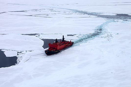 The North Pole is the northernmost point on the Earth, lying diametrically opposite the South Pole. It defines geodetic latitude 90 degrees north, as well as the direction of true north. At the North Pole all directions point south; all lines of longitude converge there, so its longitude is indefinite. Our expedition's objective was to reach the True North. Our return journey would commence from the point N90.  While on the subject, it's important to realise that there are other north poles too; namely the Magnetic Pole and the Pole of Inaccessibility.
The North Magnetic Pole is the point on the surface of Earth's Northern Hemisphere at which the planet's magnetic field points vertically downwards (in other words, if a magnetic compass needle is allowed to rotate about a horizontal axis, it will point straight down). There is only one location where this occurs. The North Magnetic Pole moves over time due to magnetic changes in the Earth's core. To illustrate, the Magnetic North Pole from the year 2001 to the year 2012 shifted by about 5 degrees, which would roughly translate to moving about 300 nautical miles! A pole of inaccessibility marks a location that is the most challenging to reach owing to its remoteness from geographical features that could provide access. Often it refers to the most distant point from the coastline. The term describes a geographic construct, not an actual physical phenomenon. Subject to varying definitions, it is of interest mostly to explorers. 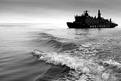 I was leading a group of 13 – each one excited to reach at a point where very few in the world can claim to go. It was indeed a trip of a life time. We had chosen Quark Expeditions for our trip. The folks are experts with polar expeditions. Things did go as planned save for an incidence when we got stranded on an island but was well managed by the Quark expedition team. The crew and the staff were indeed exceptional.
To reach the North Pole, one definitely needs to travel in an ice-breaker. Our ship was called ‘50 Years of Victory’. It was nuclear powered fired by enriched uranium. The ship had two engines each with a capacity of 37,000 horse power. With the support of 74,000 horse power, our ship cut through pack of ice, which at times was almost 10 feet thick… it was like knife cutting through butter! All the world’s nuclear powered ice-breakers are docked in Murmansk, Russia. 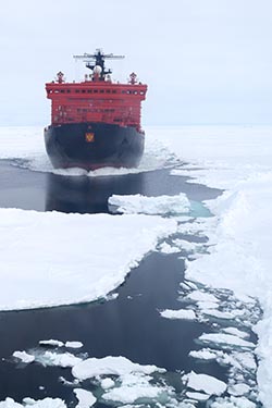 For two months in summer, these ice-breakers are hired to companies like Quark. The rest of the time, the ice-breakers are used to pave way for cargo ships. I am told that in the year 2016, these ships will be withdrawn for such charters. Was I lucky?
The captain of our ship was Valentin Davydyants and the expedition leader was Alex McNeil. The former was Russian and the latter was Canadian. Both very highly seasoned in their craft. Valentin was ably supported by a crew & staff of 140 individuals and Alex was leading a group of 15 experts in areas of wildlife, history, medicine, photography, disaster management and nature. The guests that the ship could carry was 128. A good guest to crew ratio I guess. A special mention must be made about their hotel staff. Breakfasts, lunches and dinners were served in an immaculate style in the dining room. Menus were changing every day. And for our vegetarian friends the team made special efforts to keep them happy. And at times of formal banquets, they made it even better.  My group was on Bridge Deck II. On this level we had the bar, the library and the AFT lounge. The lounge was used for lectures and other social events; the library which also doubled up as a lounge had 24 hour coffee dispensing machine and interesting books; and of course the bar was a favourite. The bar offered, with compliments, a nice collection of soft & hard drinks.
We were indeed in good hands for the next 2 weeks or so. On such voyages, one really can’t be itinerary-perfect. The weather and ice conditions enjoy the veto. We boarded the ship on July 1, 2014. The voyage was planned as follows: Day 1: Board at Murmansk Day 2 to 6: North bound through Barents Sea and the Arctic Ocean Day 7: Attain 90 degrees North position Day 8: South bound in the Arctic Ocean Day 9 & 10: Franz Josef Land Day 11 & 12: South bound through Barents Sea Day 13: Arrive Murmansk 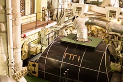 Whilst on the journey, we the ship followed Moscow time. At 12 noon every day, we would get the details of our progress and the weather conditions. Our log of day 1:
Location: 69º 02’ N, 33º 04’ E (read as sixty nine degrees 2 minutes north, thirty three degrees four minutes east) Distance from North Pole: 1258 NM (nautical miles) By an international agreement one nautical mile has been fixed as being 1852 meters. An agreement had to be reached because the nautical mile would be different at the equator than at the poles. Simply put, 1 degree would equal to 60 NM. Nautical miles are in use whilst at sea and in air. At 6 PM on day 1, the ship gave three hoots and moved. The trip was on. North Pole Image Gallery  Photo viewer Photo viewer
|
|
|
Home |
Charity |
Feedback
Privacy Policy | Terms of Usage © YoGoYo.com. All rights reserved. |


