 |
Home | Charity | Feedback |
North Pole:
The Expedition,
Arctic Ocean,
Barents Sea,
Cape Tegetthoff,
Champ Island,
Franz Josef Land,
Ninety Degrees North
Barents Sea: Gateway to the North Pole by Prakash Bang, Editor in Chief 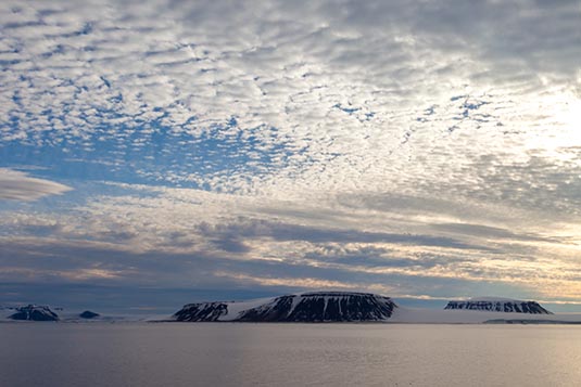 The Barents Sea is a marginal sea of the Arctic Ocean, located off the northern coasts of Norway and Russia. Known in the Middle Ages as the Murman Sea, the sea takes its current name from the Dutch navigator Willem Barentsz. It is a rather deep shelf sea, with an average depth of 230 metres and is an important site for both fishing and hydrocarbon exploration. 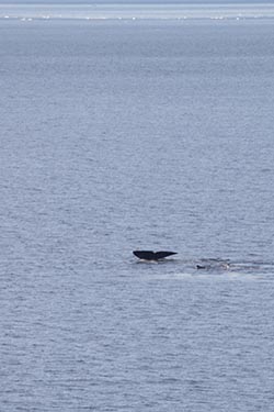 The southern half of the Barents Sea, including the ports of Murmansk (Russia) and Vardo (Norway) remain ice-free year round due to the warm North Atlantic drift. In September, the entire Barents Sea is more or less completely ice-free. Until the Winter War (1939–40), Finland's territory also reached to the Barents Sea, with the harbor at Petsamo being Finland's only ice-free winter harbor.
The Barents Sea is bordered by the shelf edge towards the Norwegian Sea to the west, and the archipelagos of Svalbard to the northwest, Franz Josef Land to the north east and Novaya Zemlya to the east. Novaya Zemlya, an extension of the Northern part of the Ural Mountains, separates the Barents Sea from the Kara Sea. Because the region is ice-free Murmansk becomes an important port year long. As we set sail, the first few hours were through the fjords before coming out in the open. Our mobile phones were working till then. Thereafter, we were mobileless and completely out of touch with our families back home. We could use the ships satellite phone, with a charge of course, to occasionally call home & our businesses. 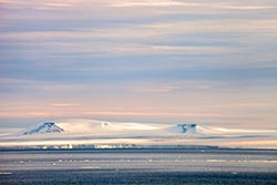 There are three main types of water masses in the Barents Sea: Warm, salty Atlantic water from the North Atlantic drift, cold Arctic water from the north, and warm, but not very salty coastal water. Between the Atlantic and Polar waters, a front called the Polar Front is formed. In the western parts of the sea (close to Bear Island), this front is determined by the bottom topography and is therefore relatively sharp and stable from year to year, while in the east (towards Novaya Zemlya), it can be quite diffuse and its position can vary a lot between years.
For decades there was a boundary dispute between Norway and Russia regarding the position of the boundary between their respective claims to the Barents Sea. The Norwegians favoured a median line, based on the Geneva Convention of 1958, whereas the Russians favoured a meridian based sector line, based on a Soviet decision of 1926. This led to a neutral "grey" zone between the competing claims that had an area of 175,000 sq.km, which is approximately 12% of the total area of the Barents Sea. The two countries started negotiations on the location of the boundary in 1974 and a moratorium on hydrocarbon exploration was declared in 1976. In 2010, Norway and Russia signed an agreement that placed the boundary equidistant from their competing claims. This was ratified and went into force on 7 July 2011, opening the grey zone for hydrocarbon exploration. 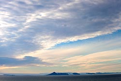 The Barents Sea contains the world largest remaining cod population, as well as important stocks of haddock and capelin. Fishing is managed jointly by Russia and Norway in the form of the Joint Norwegian - Russian Fisheries Commission, established in 1976.
Not concerned with what had happened in the past, we were enjoying our voyage on the Barents Sea. Having nothing else to do our activity on board was restricted to short visits on various decks, resting in the lounge and of when the clock struck 4 it was time to visit the bar! The typical voyage clock worked as follows: 7:30 AM: Wake-up with an announcement for the day 8:00 AM: Breakfast 9:00 AM to 12:30 PM: Lectures & Briefings 12:30 PM: Lunch 2:00 PM: Lectures, Movies, etc. 4:00 PM: Afternoon tea 6:00 PM: Recap of the day 7:30 PM: Dinner 9:00 PM: Fun time 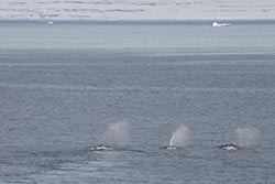 The times were subject to change based upon landing schedules & conditions. For instance, today, we had the very important mandatory Life Boat briefing at 11 AM. The team made sure that every guest was present.
The ship had an open bridge policy, meaning the guests were free to visit the bridge from where the captain and his crew navigate the ship. From the comforts of controlled climate, we could see the cracking of the ice as the ship zipped through. Few members of the expedition team were always on the bridge with their binoculars. Their job was to make an announcement as soon as they spotted wildlife… polar bears, walruses, seals, narwhals & whales. Birds of course, were in plenty.  Guests would wait for such announcements and then rush out to the nearest deck to watch life in the wilderness. We spotted a polar bear, a few walruses and the rare bowhead whales (on our return journey).
The log at 12 noon on day 2: Location: 73º 15’ N, 37º 45’ E Wind speed: 12 knots Temperature: +6.6 degrees C Distance to North Pole: 1005 NM In the evening we had the Captain’s reception giving us an opportunity to interact with the Captain and his officers. On day 3 we touched Franz Josef Land. This was not planned as per the itinerary. We had to make a brief halt at Cape Flora since we had to evacuate a Russian Expedition Team on the island. This team would spend about 3 months for their research project. There was floating ice all around making it necessary to use the ship’s helicopter, instead of the zodiacs, for their landings. Today we had the mandatory Helicopter Landing briefing at 11:30 AM. And an engine room tour for my group at 2 PM. The log at 12 noon on day 3: Location: 79º 46’ N, 49º 22’ E Wind speed: 11 knots Temperature: - 0.4 degrees C Distance to North Pole: 614 NM Barents Sea Image Gallery  Photo viewer Photo viewer
|
|
|
Home |
Charity |
Feedback
Privacy Policy | Terms of Usage © YoGoYo.com. All rights reserved. |


